
GOES-East Visible Mesoscale Sectors
These are the most recent GOES-East mesoscale sector, visible channel (0.5 km resolution), 2-hour animations. Click on an image for a larger resolution image. GOES-East ABI Flex Mode (Mode 3) scanning affords the opportunity of two moveable mesoscale sectors that are 1000×1000 km in size at the sub-satellite point. These sectors are scanned every 60 seconds. A National Weather Service Weather Forecast Office or a National Center (SPC, or NHC, for example), can request that the Mesoscale domain be moved to sample a region or feature of interest. If no requests are active, then default positions are used. These defaults were selected because they overlay major air traffic corridors. Since Mesoscale domains can change, the geographical location shown in these loops may “jump” to another geographic location mid-loop. Refer to https://vlab.noaa.gov/web/towr-s/mmm/meso-view for mesoscale sector scheduled domain changes.


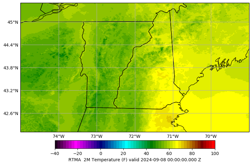
Realtime Mesoscale Analysis (RTMA)
2-meter Air Temperature

Multi-Radar Multi-Sensor (MRMS) Northeast
Composite Reflectivity Mosaic 2-Hour Loop


Multi-Radar Multi-Sensor (MRMS) Southeast
Composite Reflectivity Mosaic Loop

Lyndon Mesonet
VT Weather Analytics Center (including Lyndon Mesonet) Most Recent Station Plots
[external website]
LSC01, LSC02, LSC03, LSC04 Multi-Station Time Series
[external website]